
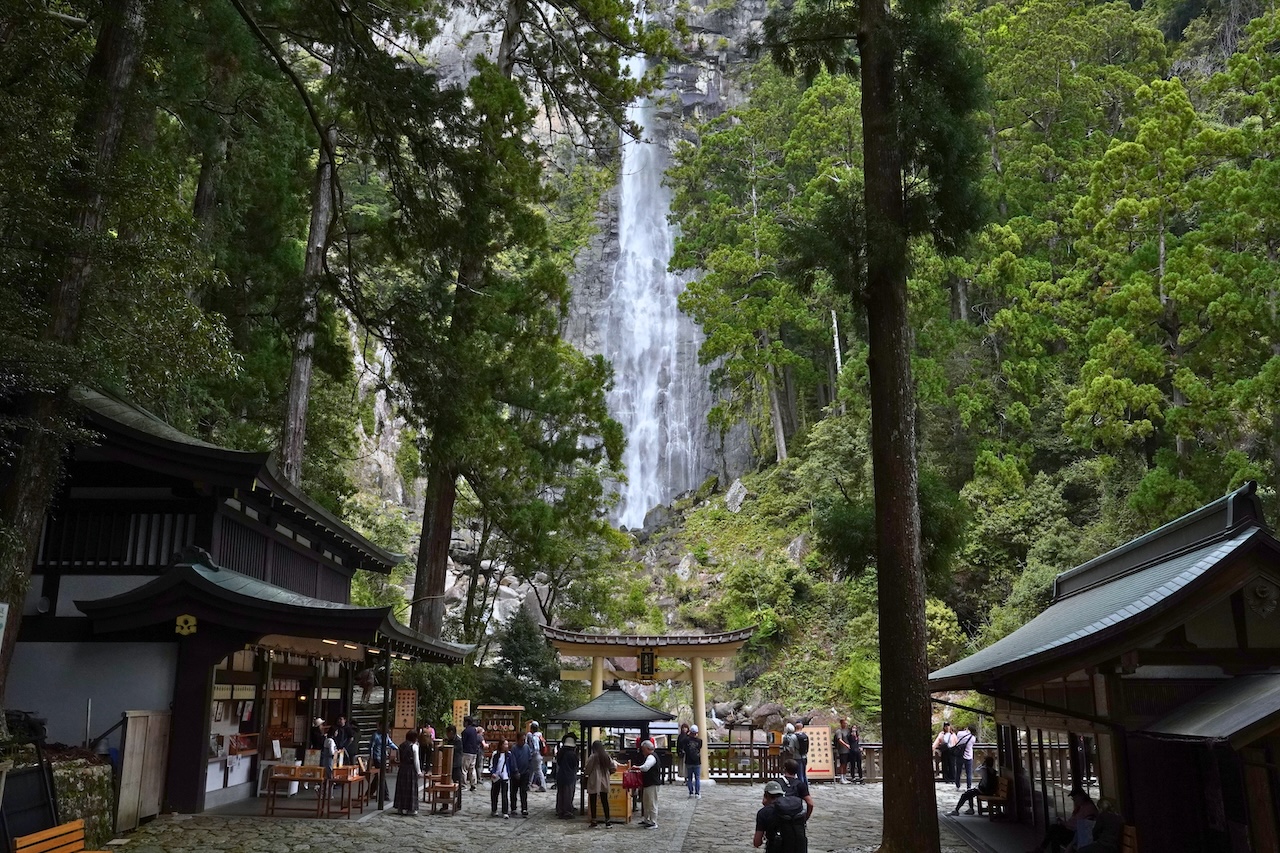
This three-day Kumano Kodo itinerary is a train and bus route through southern Wakayama Prefecture that visits all three Kumano Sanzan grand shrines. It runs from Kii-Tanabe Station to Shingu, with Kumano Hongu Taisha on day one, Kumano Nachi Taisha and Nachi Falls on day two, and Kumano Hayatama Taisha on day three. The shrines stand 20 to 40 kilometres apart, and the only walked stretch of the pilgrimage road is Daimonzaka, a stone staircase of 267 steps.
| Route | Kii-Tanabe Station, Hongu, Shingu, Kii-Katsuura, Nachi, then Shingu again |
|---|---|
| Length | 3 days and 2 nights by train and bus, both nights in Kii-Katsuura |
| Shrines visited | Kumano Hongu Taisha, Kumano Nachi Taisha and Kumano Hayatama Taisha, 20 to 40 km apart |
| Kii-Tanabe Station to Hongu | Bus from stop 2, 1 hr 35 min to 2 hr 15 min, 2,100 yen one way |
| Hongu to Shingu | Bus, 59 to 86 minutes depending on the service, 1,560 yen one way |
| Kii-Katsuura Station to Nachisan | Bus, 26 minutes, 630 yen one way. Daimonzaka stop is 18 minutes, 480 yen |
| Walking | One short section: Daimonzaka, about 600 m long with 267 stone steps |
Checked in October 2026 against sekaiisan-wakayama.jp, tb-kumano.jp.
Some places in Japan are famous. The Kumano Kodo is something different: a place people go out of their way to reach.
The Kumano Kodo is the collective name for the old pilgrimage routes that lead to the Kumano Sanzan, the three grand shrines of the southern Kii Peninsula: Kumano Hongu Taisha, Kumano Hayatama Taisha, and Kumano Nachi Taisha. Together with the routes that connect them, they were inscribed on the UNESCO World Heritage List in 2004 as part of the “Sacred Sites and Pilgrimage Routes in the Kii Mountain Range.”
I did this itinerary myself, and this is what it actually looked like.
Who This Kumano Kodo Itinerary Is For
This itinerary is a good fit if you:
- want to see a side of Japan that is not Tokyo, Kyoto, or Osaka
- are interested in Shinto, Japanese mythology, and sacred landscapes
- prefer atmosphere and forest over famous landmarks and photo queues
- do not have a driver’s license in Japan and want to travel by train and bus
- want to visit all three Kumano Sanzan shrines without rushing
- like the idea of walking part of an ancient pilgrimage route, but do not want a multi-day hike
- are willing to spend half a day getting somewhere in exchange for having it feel quiet
It is also a good option if you are already travelling between Osaka, Wakayama, Ise, or Nagoya and want to add a slower, more spiritual stop in the middle.
Two reasons I wanted to go, personally:
- To experience a deeper Japan as a Japanese person. Kumano is genuinely hard to reach, and that is exactly why I wanted to see what “old Japan” still feels like there.
- For the history and the spiritual weight. Kumano is not a place crowds pour into. But it is tied to the gods of Japanese mythology, it played a serious role in Japanese history, and it has a reputation as one of the most powerful places in the country.
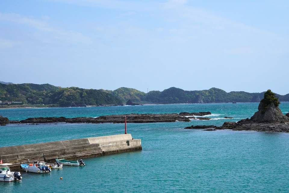
Quick Overview: 3 Days on the Kumano Kodo
Times below are a suggested guide, not fixed schedules. Bus services in this area are infrequent, always check the current timetable before you set out.
Day 1: Into the Mountains
- 09:00: Start from Kii-Tanabe Station
- 11:10: Arrive in Hongu
- 11:30: Walk to Oyunohara, the original shrine site
- 13:00: Visit Kumano Hongu Taisha
- 14:30: Bus over the mountains to Shingu
- 16:00: Ride the Kisei Main Line down the coast
- 17:30: Check in at Kii-Katsuura
- 19:00: Fresh tuna dinner by the harbour
Day 2: Nachi
- 09:30: Bus from Kii-Katsuura Station toward Nachisan
- 10:00: Climb the Daimonzaka stone-paved slope
- 11:00: Kumano Nachi Taisha and Seiganto-ji
- 11:40: Nachi Falls
- 12:30: The three-storied pagoda viewpoint
- 15:00: Back to Kii-Katsuura, walk the port town
Day 3: Shingu and the Sea
- 10:00: Train from Kii-Katsuura to Shingu
- 10:40: Kumano Hayatama Taisha and the thousand-year nagi tree
- 12:00: The old-house shopping lane beside the shrine
- 13:30: Depart from Shingu Station
Day 1: Oyunohara and Kumano Hongu Taisha
📍 Day 1 route on Google Maps: View the Day 1 route
: Kii-Tanabe Station
→ Oyunohara
→ Kumano Hongu Taisha
→ Shingu Station
→ Kisei Main Line along the coast
→ Kii-Katsuura
09:00: Start from Kii-Tanabe Station
Kii-Tanabe Station is the standard gateway to the Kumano Kodo. The Tanabe City Kumano Tourism Bureau’s information centre sits right next to it, and the limited express Kuroshio from Shin-Osaka reaches it in about two hours.
From there, a bus runs inland to Hongu Taisha-mae in roughly two hours. Buses also run from the Shirahama area, but those services go via Kii-Tanabe anyway, so they take longer, the seasonal Kumano Kodo rapid bus is the exception.
One thing to accept early: getting to Kumano is part of the experience. The bus climbs into steep river valleys, mobile signal comes and goes, and the towns get smaller. By the time you arrive, you already feel like you have left mainstream Japan behind.
11:30: Walk to Oyunohara, Where the Shrine Originally Stood
Before the shrine, go to where the shrine used to be.
Oyunohara is a sandbank at the confluence of the Kumano and Otonashi rivers. According to shrine tradition, Kumano Hongu Taisha stood on this spot from 33 BC, a legendary founding date recorded in the shrine’s own chronicles rather than a historically verified one.
Then, in August 1889, a catastrophic flood destroyed most of the shrine complex. The surviving upper halls were dismantled and re-erected on higher ground in 1891, which is where the shrine stands today.
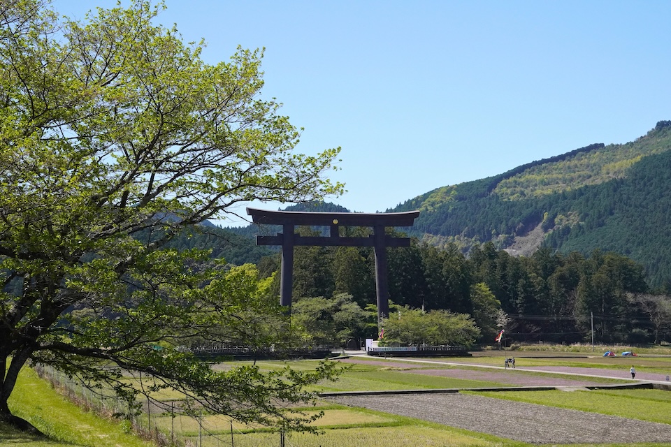
What remains at Oyunohara is a torii gate. At 33.9 metres tall and 42 metres wide, erected in 2000, it is the largest torii gate in Japan.
The surroundings are ordinary Japanese countryside: rice fields, a wide river, low hills. That contrast is exactly what makes the gate so overwhelming. Standing under it, the scale stops making sense.
The river runs right alongside, and once you sit down on the bank, the only sounds are moving water and birds. I sat there for a long time without doing anything in particular. Of everywhere on this trip, this was where I felt the spiritual weight most strongly.
13:00: Kumano Hongu Taisha
Kumano Hongu Taisha sits just a short walk from Oyunohara, on higher ground above the town.
Unlike the isolated feeling of Oyunohara, the shrine sits in the middle of Hongu’s small townscape, with shops nearby and a steady flow of people. It reads less like a monument and more like a historic shrine that is still part of ordinary daily life.
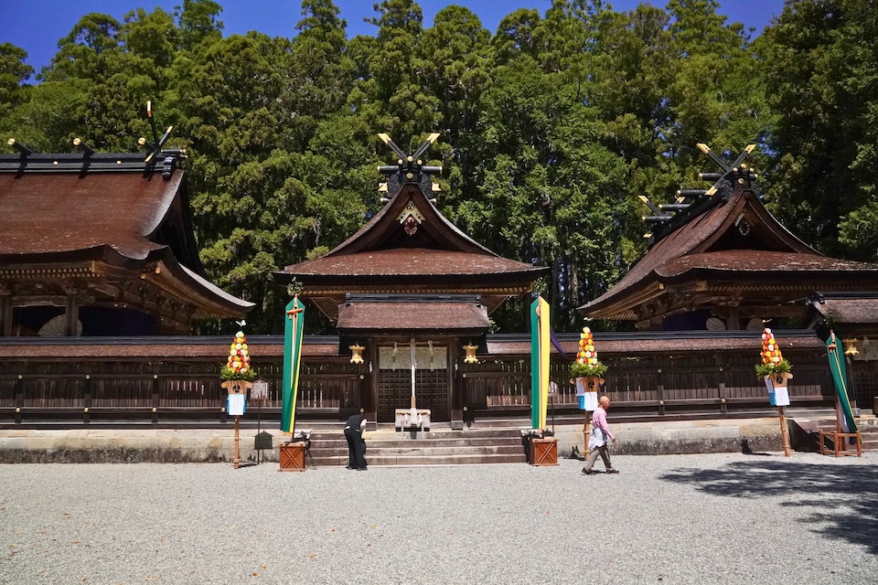
The principal deity here is Ketsumimiko-no-Okami, a deity traditionally identified with Susanoo-no-Mikoto. In the Kojiki, Susanoo is one of the three noble children born from Izanagi’s purification, alongside Amaterasu and Tsukuyomi.
By the Heian period, Kumano faith had spread through the imperial court and the aristocracy. Retired emperors and imperial ladies made the pilgrimage from Kyoto again and again, Emperor Go-Shirakawa alone is recorded as having made the journey more than thirty times. The round trip covered roughly 600 kilometres on foot and took about a month.
Today the same journey takes an afternoon.
14:30: Cross the Mountains to Shingu
There is no direct public transport from Hongu to Nachi. If you are heading toward Nachi and Katsuura, the practical route is to take the bus east to Shingu, then continue by train.
The bus down the Kumano River valley takes roughly 60 to 85 minutes and is worth staying awake for. Steep forested slopes drop straight into a wide green river almost the entire way.
16:00: Ride the Kisei Main Line Down the Coast
At Shingu, you reach the coast: and the Kisei Main Line, the local railway that runs along Wakayama’s shoreline. The JR West section between Wakayama and Shingu is also branded the Kinokuni Line.
Local trains here are two-car formations, and they are used by exactly who you would expect: students on the way home, older residents with shopping bags. When I boarded in the early afternoon it was quiet, but the carriage filled up considerably not long after.
The train rattles slowly along the sea, ducking into the hills and back out again. There is no need to do anything. Just sit by the window.
Tip: some limited express Kuroshio services run in the “Panda Kuroshio” livery, with a panda face on the nose. Which trains carry it changes daily, so treat it as a bonus rather than a plan.
17:30: Check In at Kii-Katsuura
The station is Kii-Katsuura Station, not “Nachikatsuura Station”: Nachikatsuura is the name of the town, and there is also a separate, smaller Nachi Station two stops north.
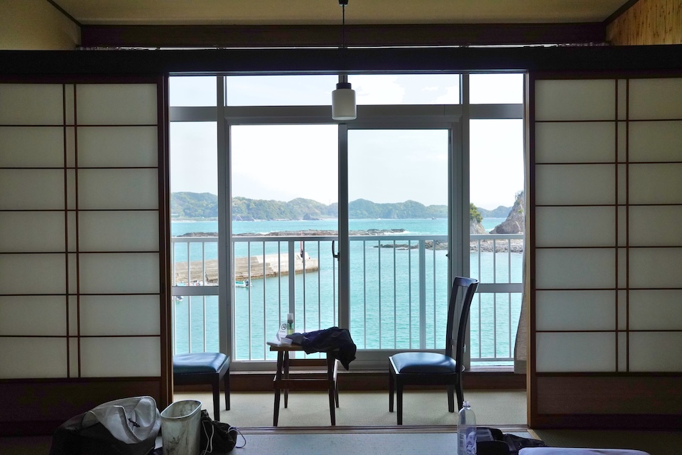
I stayed at Umi no Hotel Ichinotaki, a sea-facing inn about 15 minutes on foot from Kii-Katsuura Station, with its own hot spring baths.
19:00: Tuna by the Harbour
Katsuura is a tuna town. The port’s official claim is that it lands more fresh, longline-caught tuna than anywhere else in Japan: fresh, not frozen, which is the distinction that matters here.
The waterfront is lined with restaurants, izakaya, and plain set-meal shops all serving tuna caught that morning. This is not a refined dining destination. It is a working fishing port that happens to eat extremely well.
Day 2: Daimonzaka, Nachi Falls, and Kumano Nachi Taisha
📍 Day 2 route on Google Maps: View the Day 2 route
: Kii-Katsuura Station
→ Daimonzaka
→ Kumano Nachi Taisha
→ Seiganto-ji
→ Nachi Falls
→ Kii-Katsuura
09:30: Bus Toward Nachisan
Of the three shrines, Nachi is the easiest to reach. Buses run from Kii-Katsuura Station up to Nachisan in about 25 to 30 minutes, with Daimonzaka roughly 20 minutes in. Allowing for the walk at the top, budget around 40 to 45 minutes station-to-shrine.
10:00: Climb the Daimonzaka Slope
Get off at Daimonzaka and walk the rest.
Daimonzaka is a moss-covered stone-paved slope through towering cedar trees, around 500 to 600 metres long with 267 stone steps, depending on which source you follow. It is a genuine surviving section of the Kumano Kodo, and it is the part of this trip that feels most like a pilgrimage rather than a visit.
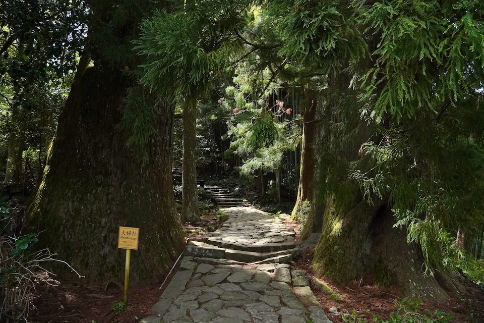
It is a climb, but a manageable one. Twenty minutes of effort, and it changes the whole character of the day. If you only walk one stretch of the old road, make it this one.
11:00: Kumano Nachi Taisha and Seiganto-ji
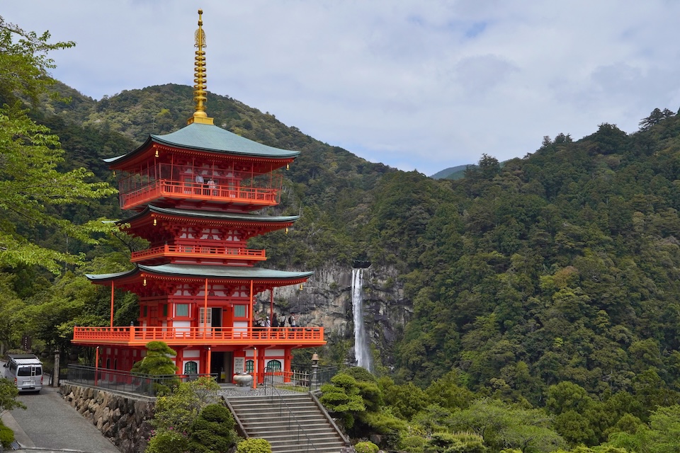
At the top, the shrine grounds open out and you can see Nachi Falls from near the halls.
Kumano Nachi Taisha shares this hillside with Seiganto-ji, a Buddhist temple: one of the clearest surviving examples in Japan of Shinto and Buddhism coexisting on the same sacred ground.
11:40: Nachi Falls
Nachi Falls drops 133 metres in a single fall, making it Japan’s longest single-drop waterfall: a specific claim worth getting right, since taller waterfalls exist in Japan when multiple tiers are counted.
The falls are not a scenic backdrop here. They are the object of worship itself, enshrined at Hiro Shrine.
12:30: The Three-Storied Pagoda Viewpoint
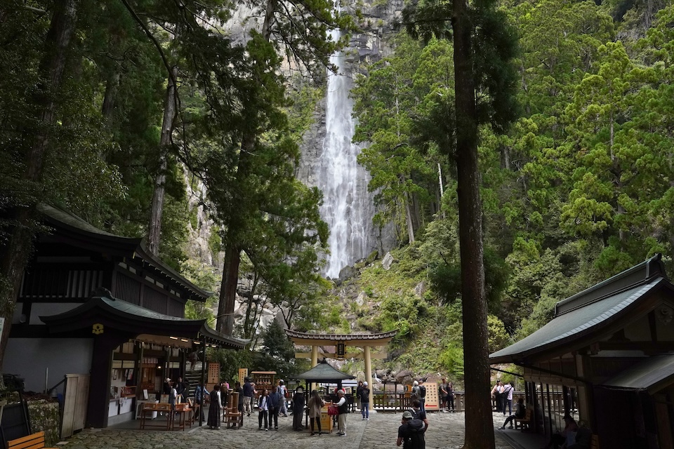
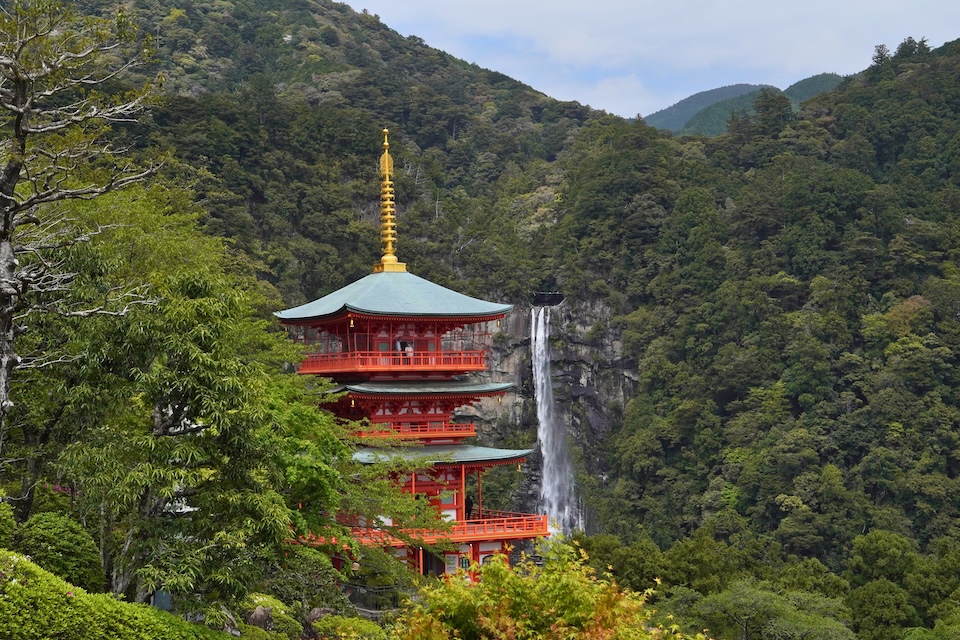
Climb back up from the falls and you reach the three-storied pagoda, part of Seiganto-ji, rebuilt in 1972. You can go inside, and there is a lift to the top floor.
The reason to come here is the composition. Looking back toward the falls with the pagoda standing in the middle distance, the vermilion tower and the white water land in a single frame. It looks less like a photograph than a painting, and it is the image most people have seen of Kumano without knowing where it was taken.
15:00: Back to the Port Town
Head back down to Kii-Katsuura and walk the harbour. After a morning of steps and cedar forest, a coastal fishing town is a good way to end the day.
Day 3: Kumano Hayatama Taisha in Shingu
📍 Day 3 route on Google Maps: View the Day 3 route
: Kii-Katsuura Station
→ Shingu Station
→ Kumano Hayatama Taisha
→ Old-house shopping lane
→ Shingu Station
10:40: Kumano Hayatama Taisha
The last of the three shrines sits inside the town of Shingu, about 15 to 20 minutes on foot from Shingu Station. You can also drive almost to the entrance. After two days of mountain roads and forest steps, the ease of it is almost strange.
Hayatama Taisha is part of the same UNESCO World Heritage inscription as the other two shrines, and the vermilion halls are striking against the surrounding green.
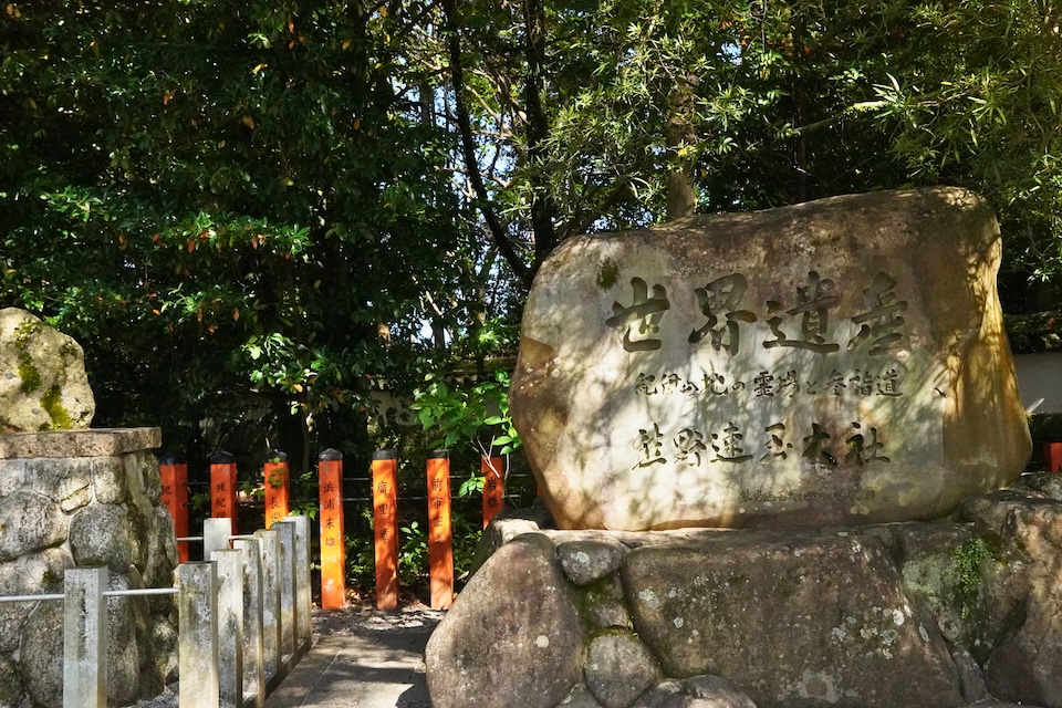
The thing you will remember, though, is the tree.
One correction worth making here: the great sacred tree in the grounds is a nagi (Nageia nagi), not a willow: the two are easy to confuse by name in Japanese. It is roughly a thousand years old, has been a designated National Natural Monument since 1940, and is generally described as the largest nagi in Japan. Tradition holds it was planted by Taira no Shigemori in 1159. Pilgrims have long carried one of its leaves with them for protection.
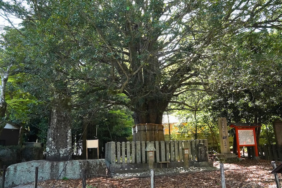
Standing under it, the sense of presence is the same as at Oyunohara. Different form, same weight.
12:00: The Old-House Lane Beside the Shrine
Right next to the shrine there is a small street of restored traditional houses, local fruit, handmade goods by local makers, a few cafés.
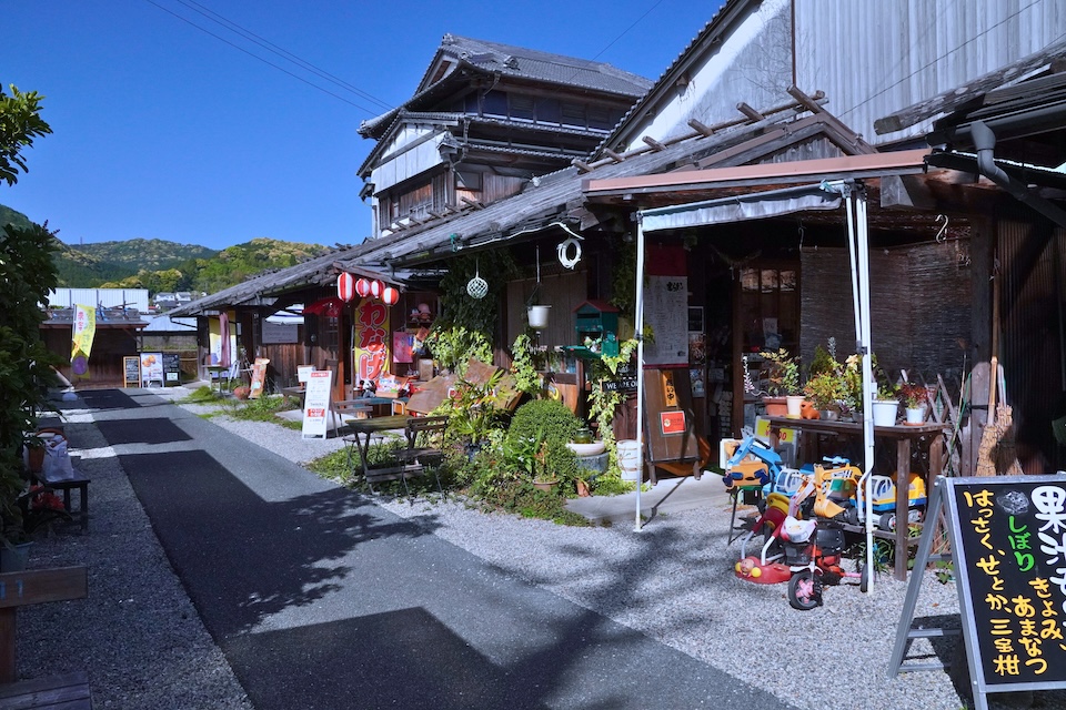
After three days of shrines and buses I was tired, and this turned out to be exactly the right thing: somewhere pleasant and unimportant to sit for an hour before the train.
Optional Stop: Kamikura Shrine
If you have extra time in Shingu and your legs still work, Kamikura Shrine sits above the town, reached by a famously steep stone stairway, with a huge boulder as its object of worship. I did not include it on this trip, but it is the obvious addition for anyone who wants one more climb.
Practical Tips for Visiting the Kumano Kodo
What Is the Difference Between the Kumano Kodo and the Kumano Sanzan?
The Kumano Sanzan are the three grand shrines: Hongu, Hayatama, and Nachi. The Kumano Kodo are the old pilgrimage routes that lead to them. Both were inscribed together on the UNESCO World Heritage List in 2004.
You do not have to walk the routes to visit the shrines. This itinerary is shrine-focused, with one short walked section at Daimonzaka.
Can You Visit the Kumano Sanzan Without a Car?
Yes: this entire itinerary was done by train and bus.
The catch is frequency, not availability. Buses in this region can run only a few times a day, so the timetable dictates the plan rather than the other way around. Check current times before each leg. A car gives you flexibility, but it is not required.
How Many Days Do You Need for the Kumano Sanzan?
Three days and two nights. That is the shortest official model itinerary covering all three grand shrines, and it matches what this trip needed.
The reason is structural: there is no direct public transport between Hongu and Nachi. That leg takes about 2 hours 15 minutes with two transfers via Shingu. Trying to compress all three shrines into one day by public transport does not work.
Shrine-Focused Trip vs Walking the Trail
| Option | Best For | What You Miss |
|---|---|---|
| Shrine-focused, 3 days by train and bus | First visits, limited time, travellers without a car | The long forest walking sections of the Nakahechi route |
| Multi-day Kumano Kodo walk | Hikers, pilgrims, people with 4+ days and mountain lodging booked | Nothing much, but it requires planning and reserved accommodation |
If it is your first time and you want to understand what Kumano is, the shrine-focused version is enough. Walking the full route is a separate trip, not an upgrade to this one.
Dual Pilgrim: The Camino de Santiago Connection
The Kumano Kodo and Spain’s Camino de Santiago run an official Dual Pilgrim programme, launched in 2015 by the Tanabe City Kumano Tourism Bureau together with Turismo de Santiago de Compostela. Complete qualifying sections of both routes and you can register as a Dual Pilgrim; the 10,000th was recognised in April 2025.
Registration points include the tourist information centre beside Kii-Tanabe Station and the Kumano Hongu Heritage Center.
When to Go
Spring and autumn are the most comfortable windows. The Tanabe City Kumano Tourism Bureau publishes a heat-safety advisory for summer and a separate guide for winter visits, which tells you most of what you need to know about the other two seasons.
Is the Kumano Kodo Crowded?
Less than Kyoto or Nara: noticeably so. Access is difficult enough that casual sightseeing traffic never really builds, and outside of Nachi I was rarely in a crowd.
That said, I would not promise emptiness. Wakayama Prefecture recorded its highest-ever foreign overnight guest numbers in 2025, and the Hongu area has repeatedly set post-pandemic records. The Kumano Kodo is quiet, but it is not undiscovered.
Where to Stay
Splitting the two nights makes sense if you want to reduce backtracking, but staying two nights in Kii-Katsuura is simpler and works well: it sits between Nachi and Shingu, has hot springs, and has the tuna.
Final Thoughts: Should You Walk the Kumano Kodo?
Yes. Without hesitation.
What makes Kumano work is the coexistence, overwhelming nature on one side, structures that have stood for centuries on the other, neither one dominating the other. There is no version of this you can get in a city.
- Access is genuinely inconvenient, which keeps visitor numbers down
- Summer brings more people, but you can still expect quiet most of the year
- Three days by public transport is enough to see all three grand shrines properly
If you want to understand Japanese culture at something deeper than a surface level, this is one of the best places in the country to do it. It just asks you to travel a little further to get there.
Frequently Asked Questions
How do you get from Osaka to Kumano Hongu Taisha by train and bus?
Kumano Hongu Taisha is reached from Osaka by limited express train and local bus. The Kuroshio runs from Shin-Osaka to Kii-Tanabe Station, where buses for the shrine leave from bus stop 2. The bus to the Hongu Taisha-mae stop takes 1 hour 35 minutes to 2 hours 15 minutes and costs 2,100 yen one way. The timetable dated September 19, 2026, lists seven regular through buses a day.
How do you get from Kumano Hongu Taisha to Kumano Nachi Taisha by public transport?
No direct bus or train runs between Kumano Hongu Taisha and Kumano Nachi Taisha. The trip takes three legs: a bus from Hongu to Shingu, a bus or train along the coast to Nachi Station or Kii-Katsuura Station, and a bus up to Nachisan. The Tanabe City Kumano Tourism Bureau gives about 2 hours 15 minutes via Nachi Station, depending on connections.
How long is the Daimonzaka slope and where does the walk start?
Daimonzaka is a stone staircase on the Kumano Kodo, about 600 metres long with 267 steps, that climbs toward Kumano Nachi Taisha, Seiganto-ji and Nachi Falls. Buses from Kii-Katsuura Station reach the Daimonzaka stop at the foot of the slope in 18 minutes. From the top of the slope, stairs continue for another 20 minutes to the shrine and temple.
What are the opening hours of the three Kumano Sanzan shrines?
Kumano Hongu Taisha is open from 8:00 AM to 5:00 PM, Kumano Hayatama Taisha from 6:00 AM to 5:00 PM, and Kumano Nachi Taisha keeps reception hours of about 8:00 AM to 4:30 PM. Hiro Shrine at Nachi Falls keeps the same hours. Kumano Nachi Taisha asks visitors not to come after dark. At Kumano Hayatama Taisha the amulet office opens at 8:00 AM, and festivals can change the hours.
Share